This is an alternative comprehensive itinerary for those planning their own trip to Iceland.
🌍 Introduction
Embark on an extraordinary journey across Iceland’s ever-changing landscapes—where fire meets ice, and nature reigns supreme. This self-drive itinerary takes you through some of the country’s most iconic and awe-inspiring destinations, including the tranquil shores of Lake Mývatn, the remote charm of Egilsstaðir, the shimmering icebergs of Jökulsárlón glacier lagoon, and the dramatic beauty of Skaftafell and Þingvellir National Parks. Along the way, you’ll traverse ancient lava fields, rolling green pastures, and volcanic terrain, with views of majestic peaks like the legendary Eyjafjallajökull.
Whether you’re chasing waterfalls, hiking glaciers, or soaking in geothermal springs, this route offers a rich tapestry of Icelandic wonders—each day revealing a new chapter in the story of this wild and captivating island.
🛣 Road Conditions & Weather
Driving in Iceland is a unique experience, but it comes with its own set of challenges—especially in winter or when venturing into the highlands. Before setting out each day, check the latest updates on:
- www.road.is – for road closures and driving alerts
- www.vedur.is – for weather forecasts and warnings
- Dial 1778 – for real-time road condition updates
These resources are essential for safe and informed travel. Iceland’s weather can change rapidly, so daily checks are non-negotiable.
⛽ Fuel Consumption & Tips
Fuel usage varies depending on your vehicle. If possible, opt for a hybrid to reduce costs and environmental impact. Here’s a rough guide:
| Vehicle | Estimated Fuel Consumption |
|---|---|
| Toyota Yaris | 5.7 liters / 100 km |
| Toyota Land Cruiser | 13 liters / 100 km |
For current fuel prices and station locations, visit www.gasvaktin.is.
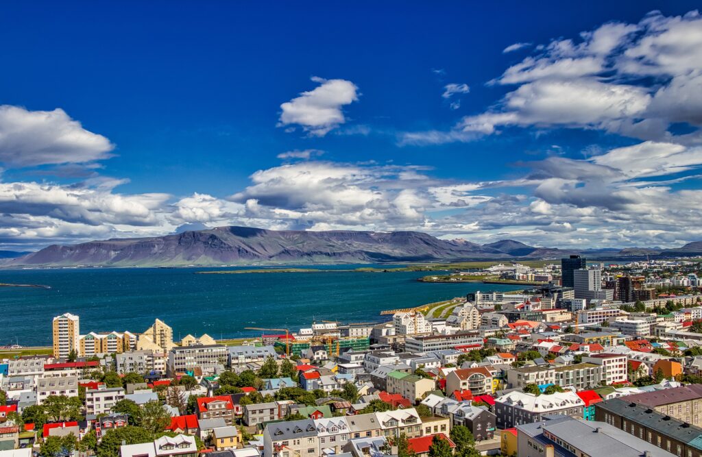
🚗 Day 1: Arrival in Airport at Keflavík – Drive to Reykjavík
Welcome to Iceland! Your adventure begins as you touch down at Keflavík International Airport, located approximately 48 km (29 mi) southwest of Reykjavík. After collecting your luggage, you’ll find convenient amenities in the arrivals hall, including duty-free shopping, information desk, ATMs, a bank, and currency exchange services.
📍 Driving Summary
- Distance: 50–225 km
- Drive Time: 45 minutes to 3 hours 40 minutes (depending on stops)
🚗 Pick Up Your Rental Car or Shuttle
Once you’re ready, collect your rental vehicle or hop aboard the Flybus shuttle that takes you to your hotel in Reykjavik. Most car rental companies have a shuttle from the arrival hall.
Follow Route 41 directly to Reykjavík for your first overnight stay.
🧭 Interesting Stops
If you arrive early and have time to explore before heading to Reykjavík, consider these highlights:
🛡️ Viking World Museum – Reykjanesbær
📍 GPS: N63 58.337 W22 31.435
Step into the Viking age at this immersive museum featuring five exhibitions, a replica Viking ship, a settlement zoo, and a playground. Learn about Norse history and culture in a hands-on environment. 🔗 Visit site
💦 Blue Lagoon – Grindavík
📍 GPS: N63 52.738 W22 26.707
Relax in the famous geothermal spa surrounded by lava fields. This geothermal spa is world-famous for its mineral-rich waters and surreal setting. The lagoon was formed by runoff from the nearby Svartsengi power plant, and its silica mud is said to have healing properties. To reach it, drive toward Reykjavík and turn right onto Route 43. Advance booking is essential. 🔗 Book here

🌋 Reykjanes Peninsula Tour
If time allows, take a detour around the Reykjanes Peninsula for dramatic coastal scenery and geological wonders. From the airport, follow Route 41 for 6 km, then turn onto Route 44, which becomes Route 425.
- 🌉 Bridge Between Continents – where the Eurasian and North American tectonic plates meet 📍 GPS: N63 51.920 W22 40.701
- 🗼 Reykjanesviti Lighthouse – Iceland’s oldest lighthouse, , guiding ships since 1878 📍 GPS: N63 48.769 W22 42.948
- 🌫️ Gunnuhver Mud Pool – bubbling geothermal activity 📍 GPS: N63 49.031 W22 41.785
- 🌊 Brimketill – A naturally carved pool formed by marine erosion 📍 GPS: N63 49.474 W22 35.561
🌈 Krýsuvík & Seltún Geothermal Area
📍 GPS: N63 53.753 W22 03.216
Drive Route 427 from Grindavík, then turn onto Route 42 to reach this colorful geothermal field. Located in the fissure zone of the Mid-Atlantic Ridge, Krýsuvík features steaming vents, bubbling mud pots, and vividly colored earth. Seltún is especially striking, with hues of yellow, red, and green created by mineral deposits.
🕍 Coastal Villages & Cultural Stops
- 🕍 Strandarkirkja Church – a charming coastal chapel 📍 GPS: N63 50.146 W21 42.279
- 🏘️ Þorlákshöfn – a small town with local character 📍 GPS: N63 51.374 W21 23.152
- 🏚️ Eyrarbakki & Stokkseyri – quaint villages with historic homes and folklore
🚣 Kayaking in Stokkseyri
📍 GPS: N63 50.187 W21 03.761
Enjoy a peaceful paddle through calm waters with Kayakferðir. Tours range from 1–3 hours and are suitable for all skill levels. 🔗 More info
🌌 Raufarhólshellir Lava Tunnel
📍 GPS: N63 56.407 W21 23.742
Located off Route 39, Walk through a lava tube formed during the Leitahraun eruption over 5,000 years ago. In winter, ice sculptures add a magical touch. 🔗 Book tour
🛏️ Overnight in Reykjavík
Settle into your hotel and enjoy your first evening in Iceland’s vibrant capital. Whether you choose to relax or explore the city’s nightlife, you’re officially on Icelandic time.

🗓️ Day 2: Reykjavík → Borgarfjörður → Akureyri
A journey through waterfalls, folklore, geothermal wonders, and Icelandic heritage
Today marks your first full day on the road, as you leave the capital behind and venture into the heart of Iceland’s countryside. This is a long but rewarding drive packed with natural beauty, cultural gems, and optional adventures. Plan your stops wisely to make the most of the day!
🛣️ Route Overview
- Depart Reykjavík via Route 1 toward Borgarfjörður
- Explore the Borgarfjörður region
- Continue north through Skagafjörður
- Arrive in Akureyri for your overnight stay
📍 Driving Summary
- Distance: 390–515 km
- Drive Time: 5.5 to 7.5 hours (excluding stops)
🐋 Hvalfjörður – “Whale Fjord”
Your first leg takes you past Hvalfjörður, a 30 km-long fjord once used as a strategic naval base by Allied forces during WWII and later as a whaling station. Today, it’s a peaceful stretch of water surrounded by dramatic mountains.
You have two options:
- 🏞️ Drive around the fjord (approx. 62 km) for scenic views
- 🚇 Take the undersea tunnel to save time – plunging 165 meters below sea level
Optional Stops:
- 🌊 Fossárétt – A tranquil waterfall near an old sheep sorting pen 📍 GPS: N64 21.205 W21 27.148
- 🏞️ Glymur Waterfall – Iceland’s tallest waterfall at 196 m. A 4-hour round-trip hike with river crossings and narrow canyon ledges. Only attempt with proper gear and caution! 📍 GPS: N64 23.455 W21 15.111
🏘️ Borgarnes – Gateway to the West
This charming town sits on the edge of Borgarfjörður and offers a glimpse into Iceland’s Viking past.
Highlights:
- 🧺 Ljómalind Farmers Market – Local crafts and fresh produce (Open 10:00–18:00)
- 🛶 Settlement Center – Two immersive exhibitions: one on Iceland’s settlement and another on Egil’s Saga, a cornerstone of Icelandic literature (Open 10:00–21:00)
🌋 Borgarfjörður Region
From Borgarnes, cross the Borgarfjarðarbrú Bridge and take Route 50 toward Hvanneyri. This region blends folklore, geothermal activity, and rural charm.
Suggested Stops:
- 🧙 Fossatún Troll Park – A playful tribute to Icelandic troll legends. Enjoy a troll-themed hike and games among impressive rock formations 📍 GPS: N64 35.552 W21 34.502
- 🍓 Kleppjárnsreykir – A roadside self-service hut selling fresh fruits and vegetables. The strawberries are especially delicious! 📍 GPS: N64 39.383 W21 24.100
🔥 Deildartunguhver & Krauma Baths
- 🌡️ Deildartunguhver – Europe’s most powerful hot spring, producing 180 liters of boiling water per second 📍 GPS: N64 40.143 W21 24.728
- 🛁 Krauma Geothermal Spa – Just 70 meters away, soak in natural hot tubs, aromatic steam rooms, and an ice plunge. The on-site restaurant serves locally sourced cuisine 🔗 Visit Krauma
📚 Reykholt – Where Nature Meets History
Drive back slightly and take Route 518 to reach Reykholt, a cultural gem nestled in the countryside.
- 🏛️ Snorrastofa – A museum dedicated to Snorri Sturluson, the 13th-century poet, historian, and politician. His works, including Heimskringla and Egil’s Saga, are foundational to Norse mythology and Scandinavian history 📍 GPS: N64 39.865 W21 17.485
- 🛁 Visit Snorri’s medieval hot pool, still preserved today
💦 Hraunfossar & Barnafoss Waterfalls
📍 GPS: N64 42.105 W20 58.402 Drive 20 km east of Reykholt to witness two stunning waterfalls:
- Hraunfossar – Water emerges from beneath lava fields into the Hvítá river
- Barnafoss – Named after a tragic legend of two children who fell into the river on Christmas Eve
🏕️ Húsafell – Adventure Base
📍 GPS: N64 42.115 W20 52.189 A popular resort area with summer homes, a campsite, swimming pool, and restaurants.
Optional Excursions:
- ❄️ Ice Cave Tour in Langjökull Glacier – Explore a man-made tunnel inside Iceland’s second-largest glacier. Includes chambers and even a wedding chapel! 🔗 Book here
- 🕳️ Víðgelmir Lava Cave – One of the largest lava tubes in the world, filled with ice formations and lava sculptures 📍 GPS: N64 45.116 W20 48.067 🔗 Book here
⏳ Note: These tours take 1.5–4 hours. You may need to adjust other stops accordingly.
🐴 Skagafjörður Region
Continue north on Route 1 through Blönduós and Langidalur Valley. Known for its horse breeding, this region offers pastoral beauty and cultural heritage.
Highlights:
- 🐎 Hestasport Horse Riding – Tours available from Varmahlíð 🔗 Visit site
- 🏡 Glaumbær Turf House Museum – One of Iceland’s best-preserved turf farms 📍 GPS: N65 36.714 W19 30.299
- ⛪ Víðimýri Turf Church – A beautifully restored 1834 church 📍 GPS: N65 32.349 W19 28.270

🏰 Historical Detours (Optional)
- 🏞️ Hólar – A medieval cultural center and former bishop’s seat. Visit the historic church and learn about Jón Arason, the last Catholic bishop of Iceland 📍 GPS: N65 44.009 W19 06.653
- 🎣 Hofsós – A fishing village with a scenic fjord-side pool and emigration history 📍 GPS: N65 53.768 W19 24.614
🌆 Arrival in Akureyri – “Capital of the North”
📍 GPS: N65 40.934 W18 05.543 Nestled along Eyjafjörður fjord, Akureyri is Iceland’s second-largest town. Explore its botanical gardens, visit the iconic church, stroll the pedestrian zone, or unwind in the local pool.
Must-see Stop:
🎄 Jólagarðurinn – The Christmas Garden – A magical year-round shop filled with Icelandic ornaments, toys, and sweets
🛏️ Overnight in Akureyri
Check into your hotel and enjoy a well-earned rest after a full day of exploration.
🗓️ Day 3: Akureyri → Lake Mývatn → Akureyri
Volcanic Landscapes, Geothermal Marvels & Birdlife in Iceland’s North
Today you’ll explore the extraordinary region surrounding Lake Mývatn—one of Iceland’s most geologically active and ecologically rich areas. Formed by a volcanic eruption over 2,300 years ago, the lake and its surroundings are a showcase of lava formations, steaming vents, craters, and unique birdlife. Be sure to allow plenty of time to take in the natural wonders and folklore that define this magical part of the country.
🛣️ Route Overview
- Depart Akureyri via Route 1
- Explore Lake Mývatn and surrounding geothermal sites
- Return to Akureyri for overnight stay
📍 Driving Summary
- Distance: Approx. 230 km
- Time: Approx. 3 hours 20 minutes (excluding stops)
🌊 Goðafoss – “Waterfall of the Gods”
📍 GPS: N65 41.071 W17 31.392
Just off Route 1 on your way to Mývatn, stop at this stunning horseshoe-shaped waterfall. Legend says that in the year 1000, when Iceland converted to Christianity, pagan idols were thrown into the falls—hence the name. It’s a powerful and photogenic site with easy access and walking paths.
🦆 Lake Mývatn Region
From Akureyri, follow Route 1 east toward Lake Mývatn—one of Iceland’s most geologically active and ecologically rich areas. Formed by a volcanic eruption over 2,300 years ago, the lake is shallow and nutrient-rich, attracting an extraordinary variety of birdlife, especially ducks. The surrounding landscape is a surreal mix of lava fields, craters, and geothermal activity.
Suggested Stops:
- 🌋 Skútustaðir Pseudo-Craters – Walk among crater-like formations created when lava flowed over wetlands, causing steam explosions. A scenic loop trail offers panoramic views of the lake and lava fields 📍 GPS: N65 34.039 W17 01.666
- 🪨 Dimmuborgir Lava Formations – Explore a labyrinth of lava pillars, arches, and caves—remnants of a collapsed lava tube. According to legend, this is where Satan landed after being cast from heaven 📍 GPS: N65 35.486 W16 54.759
- 🌫️ Námaskarð / Hverarönd Geothermal Field – One of Iceland’s largest sulphuric hot spring areas, with bubbling mud pots and steaming fumaroles. Stay on marked paths due to thin crusts and boiling ground 📍 GPS: N65 38.660 W16 48.249
- 🌋 Víti Crater & Leirhnjúkur Lava Field – Take Route 863 to reach Víti, a striking explosion crater filled with turquoise water. Nearby, hike through the Leirhnjúkur lava field, shaped by eruptions from 1975–1984 📍 GPS: N65 02.774 W16 43.374
🍽️ Dining & Relaxation
🐄 Vogafjós Cowshed Café
Located at Vogar Farm, this cozy restaurant is built into a working cowshed. Enjoy homemade Icelandic dishes while watching the cows being milked through glass windows. 🔗 Visit site
💦 Mývatn Nature Baths – Jarðböðin
📍 GPS: N65 37.500 W16 50.520
End your day with a soak in this serene geothermal lagoon. Though man-made, the water is naturally heated and rich in minerals. Temperatures range from 36–40°C, offering a relaxing alternative to the Blue Lagoon. 🔗 Book here
🛏️ Return to Akureyri
After a full day of exploration, drive back to Akureyri via Route 1 and settle in for the night.
🗓️ Day 4: Akureyri → Tjörnes Peninsula → Dettifoss → Ásbyrgi → Egilsstaðir
Whale Watching, Waterfalls, Forests & the Wild East
Today’s journey takes you from the northern town of Akureyri to the remote beauty of East Iceland. Along the way, you’ll pass through charming fishing villages, dramatic coastal cliffs, powerful waterfalls, and lunar-like highlands. This route offers a mix of wildlife encounters, Norse mythology, and geological marvels—ending in the lush valley of Egilsstaðir.
🛣️ Route Overview
- Depart Akureyri via Route 1
- Whale watching in Húsavík
- Scenic drive along Tjörnes Peninsula
- Explore Ásbyrgi canyon and Dettifoss waterfall
- Cross Möðrudalur highlands to Egilsstaðir
📍 Driving Summary
- Distance: 350–430 km
- Drive Time: 5 to 6 hours 10 minutes (excluding stops)
🐋 Húsavík – Capital of Whale Watching
Follow Highway 1 and then Route 85 (or 845) north from Akureyri to reach Húsavík, a picturesque fishing village known as Iceland’s whale watching capital. The town offers a variety of boat tours where you can spot humpbacks, minke whales, and seabirds in Skjálfandi Bay.
🌊 Tjörnes Peninsula
Continue along Route 85, hugging the coastline of the Tjörnes Peninsula. If weather permits, make a short stop at the northern tip for sweeping ocean views and seabird spotting.
🏞️ Ásbyrgi Canyon
📍 GPS: N66 00.105 W16 30.787
A dramatic horseshoe-shaped gorge believed in Norse mythology to be the hoofprint of Sleipnir, Óðinn’s eight-legged horse. Towering cliffs and lush vegetation make this a perfect spot for a walk or picnic.
🌊 Dettifoss Waterfall
South of Ásbyrgi, Dettifoss is Iceland’s most powerful waterfall—thundering 44 meters into a deep canyon and stretching 100 meters wide. The ground trembles beneath your feet as you approach this awe-inspiring force of nature.
📍 GPS: N65 48.863 W16 22.742 (approximate)
⚠️ Important Road Info
- Road 864: Gravel, potholed, closed in winter. Only suitable for sturdy vehicles.
- Road 862: Paved and open year-round to Dettifoss (from Mývatn side). Beyond Dettifoss, only passable by 4WD.
- 🚶 Walk approx. 1.5 km (30 minutes) from parking to the waterfall. 🔗 Check road conditions
🏜️ Möðrudalur Highlands
After Dettifoss, continue south to rejoin Route 1. Drive through the barren, moon-like landscapes of Möðrudalur—one of Iceland’s most remote regions.
Suggested Stop:
- 🏡 Möðrudalur Farm – A historic and isolated farm with an old-fashioned café called Fjalladýrð. A cozy place to rest and refuel before continuing east 📍 GPS: N65 22.505 W15 53.099
🌳 Egilsstaðir & Surroundings
📍 GPS: N65 15.702 W14 24.028
Located on the banks of Lake Lögurinn, Egilsstaðir is the largest town in East Iceland. The lake stretches 35 km and is Iceland’s third largest. The surrounding area offers forest walks, cultural sites, and wildlife encounters.
Suggested Stops:
- 🌲 Hallormsstaður Forest – Iceland’s largest forest, home to walking trails and wild reindeer. A peaceful retreat for nature lovers 📍 GPS: N65 05.756 W14 44.485
- 📚 Skriðuklaustur – A cultural center in Fljótsdalur housing the Institute of Gunnar Gunnarsson. Explore the author’s legacy and enjoy refreshments at Klausturkaffi 📍 GPS: N65 02.460 W14 57.146 🔗 Visit site
🛏️ Overnight in Egilsstaðir
Settle into your accommodation and enjoy the quiet charm of East Iceland.
🗓️ Day 5: Egilsstaðir → East Fjords → Höfn
Fishing Villages, French Heritage & Coastal Wonders
Today’s journey takes you along the rugged and remote East Fjords, where towering mountains meet the sea and charming villages dot the coastline. This region is rich in history—from British wartime outposts to French fishing legacies—and offers stunning views, cultural stops, and geological marvels. You’ll end the day in the seaside town of Höfn, famous for its lobster (actually Langoustine) cuisine and dramatic glacier views.
🛣️ Route Overview
- Depart Egilsstaðir via Route 1
- Explore fjords and villages along the eastern coast
- Arrive in Höfn for overnight stay
📍 Driving Summary
- Distance: 270–290 km
- Drive Time: 3 hours 50 minutes to 4 hours 10 minutes (excluding stops)
🌊 Reyðarfjörður – Fjord of History
📍 GPS: N65 01.942 W14 12.927
Drive south from Egilsstaðir on Route 1 toward Reyðarfjörður, the longest and widest fjord in East Iceland. During WWII, British forces occupied the area, leaving behind barracks and shelters that still stand today.
Suggested Stop:
- 🪖 War Museum – Housed in an old army camp, this museum offers artifacts, uniforms, and a short film about the lives of soldiers and locals during the war. Open 13:00–17:00 (June–August)
🇫🇷 Fáskrúðsfjörður – French Connection
📍 GPS: N64 55.796 W14 00.686
Continue through the tunnel or take the scenic coastal road (Route 955, partly gravel) to Fáskrúðsfjörður, a village known for its French heritage. Street signs are in both Icelandic and French, and the town honors its history with a dedicated museum.
Suggested Stop:
- 🏥 French Museum – Located in the Doctor’s House and French Hospital, this museum traces the bond between Iceland and France during the fishing boom, when up to 400 French ships docked here. Open 10:00–18:00 (May 15–Sept 15)
⛰️ Stöðvarfjörður – Art & Minerals
📍 GPS: N64 49.956 W13 52.238
A small town surrounded by dramatic peaks like Steðji, Hellufjall, and Súlur. The community thrives on fishing, tourism, and creativity.
Suggested Stop:
- 🪨 Petra’s Stone Collection – A remarkable private collection of rare minerals and stones gathered by Petra since childhood. A must-see for geology lovers 📍 GPS: N64 50.123 W13 52.841
🐚 Djúpivogur – Sculpture by the Sea
📍 GPS: N64 39.373 W14 17.044
After passing through Breiðdalsvík (📍 GPS: N64 47.494 W14 00.150), continue to Djúpivogur, a charming village with artistic flair. The road between Breiðdalsvík and Djúpivogur includes a 10 km gravel stretch.
Suggested Stop:
- 🥚 Eggin í Gleðivík – An outdoor sculpture by Sigurður Guðmundsson featuring 34 stone eggs representing local bird species. Located about 1 km from the village center.
🏞️ Vestrahorn & Stokksnes Peninsula
📍 GPS: N64 15.235 W14 59.599
Before reaching Höfn, take a detour via Route 888 to visit Vestrahorn—one of Iceland’s most photographed mountains. Rising steeply from a black sand beach, it’s a haven for birdwatchers and seal spotters. Drive carefully on the unmarked dirt road.

🦞 Höfn – Lobster Capital of Iceland
📍 GPS: N64 15.094 W15 12.665
Arrive in Höfn via Route 99, passing through the Almannaskarð tunnel, which replaced a steep mountain pass often closed in winter. Höfn is renowned for its fresh lobster—try it grilled, in soup, or even on pizza!
Suggested Stop:
- 📚 Gamlabúð – Vatnajökull National Park Visitor Centre – Learn about the region’s geology, glaciers, birdlife, and climate change. The center also features a shop with books and local products. Open daily 09:00–17:00
🛏️ Overnight in Höfn
Check into your hotel and enjoy a seafood dinner with glacier views.
🗓️ Day 6: Höfn → Glacier Lagoon → Skaftafell → Vík
Glaciers, Lagoons, Lava Fields & Black Sand Beaches
Today’s journey takes you west along Iceland’s dramatic south coast, with the mighty Vatnajökull Glacier as your constant companion. You’ll visit iceberg-filled lagoons, hike beneath glaciers, explore basalt formations, and end the day in the coastal village of Vík – home to Iceland’s iconic black sand beaches.
🛣️ Route Overview
- Depart Höfn via Route 1
- Explore Vatnajökull region and Skaftafell National Park
- Visit Kirkjubæjarklaustur and Fjaðrárgljúfur canyon
- Arrive in Vík for overnight stay
📍 Driving Summary
- Distance: Approx. 285 km
- Drive Time: Approx. 4 hours (excluding stops)
📚 Þórbergssetur Cultural Center
📍 GPS: N64 07.786 W16 01.079
Located at Hali farm, this museum honors Icelandic writer Þórbergur Þórðarson (1888–1974). The building’s façade features giant book spines, and inside you’ll find exhibits on his life, literature, and the local culture. Open daily 09:00–20:00
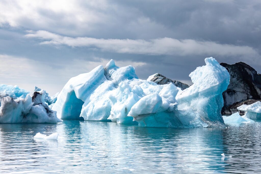
❄️ Jökulsárlón Glacier Lagoon
📍 GPS: N64 02.763 W16 10.645
A must-see stop where massive icebergs calve from Vatnajökull Glacier and drift across a serene lagoon toward the sea. The surreal beauty of floating ice and nearby Diamond Beach makes this one of Iceland’s most photographed locations.

Possible Activity:
- 🛶 Boat Tours – It’s not necessary to take a boat tour, but if you’d like there amphibian boats (30–40 min) for a closer look at the icebergs. Available daily 10:00–17:00 (May 15–Sept 15) 🔗 Book here
🐦 Ingólfshöfdi Bird Cliff
📍 GPS: N63 48.191 W16 38.320
You can see puffins in Iceland from late April to mid-August, with the peak viewing season in June and July. During this time, over 60% of the world’s Atlantic puffin population nests in Iceland, making it one of the best places on Earth to observe them.
Located near Fagurhólsmýri, this isolated headland is accessible only by tractor-drawn wagon across wetlands. It’s a nesting site for puffins and other seabirds, and the legendary landing spot of Iceland’s first settler, Ingólfur Arnarson. Tour duration: 3 hours 🔗 Book here
The tractor tour to Ingólfshöfði takes 3 hours and is only available from May 20 to August 20. If you include this, you’ll need to cut Skaftafell or Jökulsárlón short.
If you dont want to pay for a tour, Puffins nexting grounds can also be viewed at Dyrhólaey (below in Day 7).

🏞️ Skaftafell National Park
📍 GPS: N64 00.934 W16 57.891
Nestled between glaciers and black sand deserts, Skaftafell is a lush oasis offering hiking trails, waterfalls, and glacier views. Visit Svartifoss waterfall, known for its dark basalt columns, and explore the visitor center for trail maps and info.
Suggested Activity:
- 🧊 Glacier Hike – “Blue Ice Experience” on Svínafellsjökull glacier tongue. A 2.5–3 hour guided hike across glacial terrain. 🔗 Book here ⏳ Note: Tour requires time; adjust other stops accordingly.
🪨 Dverghamrar – “Dwarf Rocks”
📍 GPS: N63 51.058 W17 51.594
A roadside stop featuring a belt of basalt columns believed in folklore to be the homes of dwarves. Located a few kilometers before Kirkjubæjarklaustur.
🌄 Kirkjubæjarklaustur Village
📍 GPS: N63 47.406 W18 02.932
A peaceful village with scenic hiking trails and historical sites.
Suggested Stops:
- 💧 Systrafoss Waterfall – A short hike leads to this twin waterfall with panoramic views from the mountain edge
- 🧱 Kirkjugólf – “Church Floor” – A naturally eroded basalt formation resembling a tiled floor 📍 GPS: N63 47.720 W18 02.787
🌊 Fjaðrárgljúfur Canyon
📍 GPS: N63 46.160 W18 10.195
A breathtaking 100-meter deep, 2-km long canyon carved by glacial meltwater at the end of the last Ice Age. The Fjaðrá river flows through its mossy cliffs.
🚗 Directions: Before reaching Kirkjubæjarklaustur, turn left onto Route F206 (to Lakagígar). After a few minutes, continue straight past the Laki turnoff. Road may be impassable in wet conditions.
🌋 Eldhraun Lava Field & Mýrdalssandur
Drive across Eldhraun, one of the world’s largest lava fields, formed during the catastrophic Laki eruption of 1783. Continue through the black sand desert of Mýrdalssandur toward Vík.
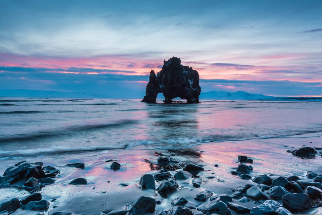
🖤 Vík & Reynishverfi Black Sand Beaches
📍 GPS: N63 25.000 W19 00.000 (approximate)
Arrive in Vík, a coastal village known for its dramatic black sand beaches. A short drive on Route 215 takes you to Reynishverfi, where basalt sea stacks rise from the surf.
⚠️ Safety Warning: Strong currents and sneaker waves make this area dangerous. Stay well back from the water’s edge.
🛏️ Overnight in Vík/Skógar Area
Check into your accommodation and enjoy the peaceful seaside atmosphere.

🗓️ Day 7: Vík → Geysir → Gullfoss → Þingvellir → Reykjavík
South Coast Wonders, Geothermal Marvels & Icelandic Heritage
Your final full day on the road takes you from the black sand beaches of Vík to the legendary Golden Circle. Along the way, you’ll encounter dramatic waterfalls, geothermal pools, volcanic exhibitions, and the birthplace of Iceland’s democracy. It’s a day packed with nature, culture, and unforgettable views.
Warning: This is a very full day. Please choose your stops wisely.
🛣️ Route Overview
- Depart Vík via Route 1
- Visit Skógar, Seljalandsfoss, and Hvolsvöllur
- Explore Flúðir, Geysir, Gullfoss, and Þingvellir
- Arrive in Reykjavík for overnight stay
📍 Driving Summary
- Distance: 300–350 km
- Drive Time: 4 hours 30 minutes to 5 hours 20 minutes (excluding stops)
🖤 Vík & Reynishverfi Beaches
Start your day with a walk along the famous black sand beach in Vík or take a short drive to Reynishverfi (Route 215), known for its basalt sea stacks and powerful waves.
⚠️ Safety Warning: The sea here is extremely dangerous. Sneaker waves can pull visitors into the ocean—stay well back from the water’s edge.

Must-See Stop:
- 🌉 Dyrhólaey – A 120-meter promontory with a massive sea arch formed by erosion. It’s a nesting site for puffins and other seabirds. Closed during breeding season until approx. June 26. Puffins can be viewed there from July-mid-August 📍 GPS: N63 24.000 W19 07.000 (approximate)
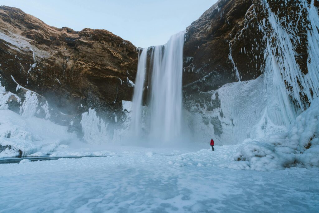
💦 Skógafoss Waterfall
📍 GPS: N63 31.707 W19 29.879
One of Iceland’s tallest waterfalls, Skógafoss drops 60 meters in a powerful cascade. A staircase leads to the top for panoramic views.
Suggested Stop:
- 🏛️ Skógar Museum – A cultural heritage collection of 15,000 artifacts across three museums and six historic buildings. Founded by Þórður Tómasson
🏊 Seljavallalaug Geothermal Pool
📍 GPS: N63 33.554 W19 37.332 Located in Eyjafjöll, this hidden pool requires a 30-minute hike each way. The last 5 km of road are gravel—drive carefully and bring your swimsuit.
🌈 Seljalandsfoss Waterfall
📍 GPS: N63 36.921 W19 59.050
A picturesque waterfall you can walk behind. The path is slippery—use caution.
🌋 Hvolsvöllur & Hella Region
Continue west on Route 1 through the villages of Hvolsvöllur and Hella.
Suggested Stop:
- 🌋 Lava Centre – An interactive exhibition on Iceland’s volcanic and seismic activity. Learn about eruptions, rift systems, and glacial floods 📍 GPS: N63.7547 W20.2372 🔗 Visit site
🌿 Flúðir & Surroundings
Turn right onto Route 30 before Selfoss to reach Flúðir, a geothermal village.
Suggested Stops:
- ⛪ Skálholt – A historic site that was the seat of Icelandic bishops for centuries. Visit the modern church and learn about its religious legacy 📍 GPS: N64 07.524 W20 31.543
- 🛁 Secret Lagoon – A natural hot spring pool surrounded by bubbling geothermal spots. Water temperature stays between 38–40°C year-round 📍 GPS: N64 08.238 W20 18.557 🔗 Visit site
🌡️ Geysir Geothermal Area
📍 GPS: N64 18.848 W20 18.133
Home to Strokkur, a geyser that erupts every 5–10 minutes, shooting water up to 20 meters. The area also features bubbling hot springs and fumaroles.

💧 Gullfoss Waterfall
📍 GPS: N64 19.641 W20 07.164 Just 10 km from Geysir, Gullfoss is one of Iceland’s most iconic waterfalls. It plunges into a deep canyon in two dramatic tiers.
🧭 Þingvellir National Park
📍 GPS: N64 15.635 W21 07.337
A UNESCO World Heritage Site and the birthplace of Iceland’s parliament in the 10th century. Walk between tectonic plates and explore the Almannagjá fissure. Visitor center offers historical and geological insights.
🐎 Hveragerði Region
From Þingvellir, drive toward Selfoss and Hveragerði via Route 36 and Route 1.
Suggested Stops:
- 🐴 Eldhestar Horse Riding – Ride Icelandic horses through scenic landscapes of volcanoes, rivers, and coastlines 📍 GPS: N63 59.171 W21 10.193 🔗 Visit site
- 🥾 Reykjadalur Hot Spring Hike – A 2-hour round-trip hike to a geothermal river. The trail starts steep but rewards you with a natural hot spring in the mountains 📍 GPS: N64 01.037 W21 11.738
🛏️ Overnight in Reykjavík
Return to Reykjavík via Route 1 and check into your hotel for your final night in Iceland.
🗓️ Day 8: Departure from Reykjavík → Keflavík Airport
Farewell to Iceland: Final Explorations or Journey Home
Your Icelandic adventure comes to a close today. Whether you’re heading straight to Keflavík Airport or spending one last day soaking in Reykjavík’s vibrant culture, this is your chance to reflect, relax, and enjoy the final moments of your journey.
🛣️ Route Overview
- Explore Reykjavík
- Depart Reykjavík via Route 41
- Return rental vehicle at Keflavík Airport
- Optional final sightseeing in Reykjavík or Reykjanes Peninsula
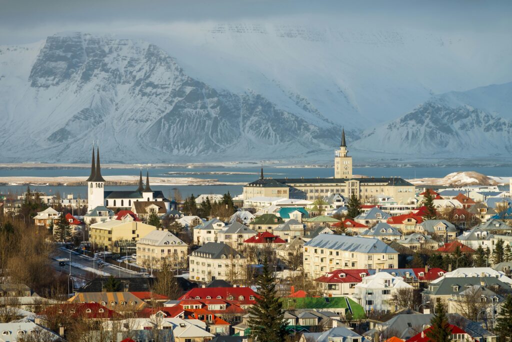
🏙️ Reykjavík – Iceland’s Capital of Culture
Reykjavík is Iceland’s largest city. In winter, its mysterious atmosphere is shaped by just four hours of daylight, while summer brings nearly 24 hours of sunshine and endless energy.
Suggested Stops:
- 🚶 Tjörnin Lake & Town Hall – A peaceful walk by the city pond, with views of swans and sculptures
- 🏛️ Austurvöllur Square – Home to Iceland’s Parliament building
- 🛍️ Laugavegur – Reykjavík’s main shopping street, lined with boutiques, galleries, and cafés
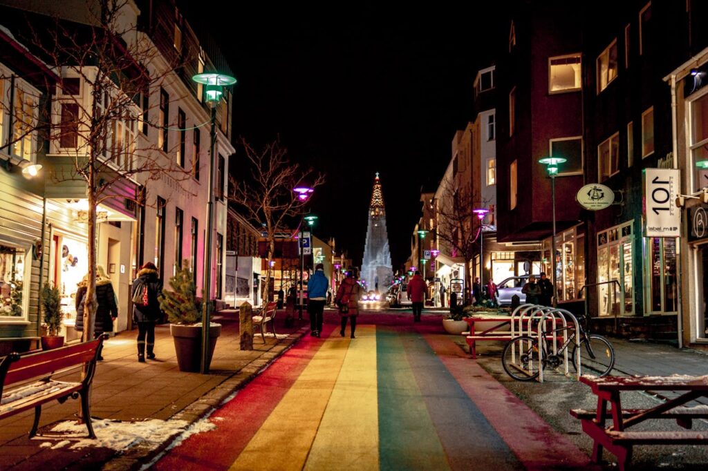
- ⛪ Hallgrímskirkja – The city’s iconic church with panoramic views from the tower
- 🌐 Perlan – A futuristic dome offering a 360° view of the city and interactive exhibitions
🖼️ Museums & Cultural Sites
Reykjavík’s museums offer a deep dive into Icelandic history and art.
Suggested Stops:
- National Museum of Iceland
- National Gallery of Iceland
- Reykjavík Art Museum (three locations)
- Settlement Exhibition
- Árbær Open Air Museum
🐋 Whale Watching at the Harbor
Head to the Old Harbor for a chance to see whales and dolphins in their natural habitat. Tours depart daily and offer a memorable farewell to Iceland’s marine life.
🍲 Taste of Iceland
Treat yourself to a bowl of Icelandic lamb soup or explore the city’s culinary scene. Reykjavík is known for its fresh seafood and creative cuisine.
🌿 Laugardalur Valley
Relax in an Icelandic swimming pool with outdoor hot pots, or stroll through the botanical gardens. A perfect way to unwind before your flight.
🌋 Reykjanes Peninsula
If you missed it on Day 1, consider a final loop through the Reykjanes Peninsula.
Suggested Stops:
- 💦 Blue Lagoon – Soak in geothermal waters surrounded by lava fields
- 🌫️ Krýsuvík & Seltún – Colorful geothermal areas with steaming vents
- 🗼 Reykjanesviti Lighthouse – Iceland’s oldest lighthouse
- 🌋 Gunnuhver Mud Pot – Bubbling geothermal activity named after a ghost
- 🕳️ Raufarhólshellir Lava Tunnel – Explore Iceland’s subterranean volcanic past
✈️ Keflavík International Airport
📍 GPS: N63 59.789 W22 37.346
Drive west on Route 41 to reach the airport. Be sure to allow time for vehicle return and check-in procedures. If your flight is later in the day, consider a few final stops before departure.
All opinions expressed in this blog are our own. We are not affiliated with, sponsored by, or partnered with any of the places, recommendations, or links mentioned.